Burlingame San Mateo Co California El Camino Real Highway Real Photo Postcard
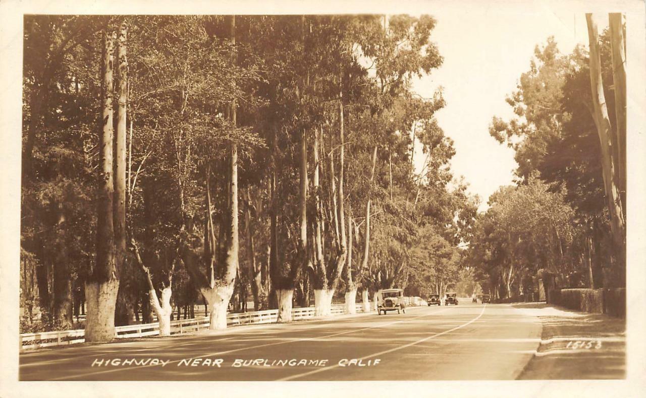
The highway near Burlingame, California, pictured here, represents a segment of the burgeoning transportation infrastructure on the San Francisco Peninsula during the early 20th century. Burlingame, incorporated in 1908, grew as an upscale residential suburb connected to San Francisco, and its roadways were vital for both local and regional transit. This particular stretch was likely part of a major thoroughfare, such as El Camino Real, which served as the primary artery connecting the various communities along the peninsula.
The scene, with its characteristic eucalyptus trees lining the route and a number of early automobiles, points to the 1920s or early 1930s. This era saw a significant increase in car ownership and the corresponding demand for improved road networks across California. The widespread planting of eucalyptus, though not native, became a common practice along California's roadsides in the late 19th and early 20th centuries, contributing to the distinctive visual landscape of the period.
The scene, with its characteristic eucalyptus trees lining the route and a number of early automobiles, points to the 1920s or early 1930s. This era saw a significant increase in car ownership and the corresponding demand for improved road networks across California. The widespread planting of eucalyptus, though not native, became a common practice along California's roadsides in the late 19th and early 20th centuries, contributing to the distinctive visual landscape of the period.