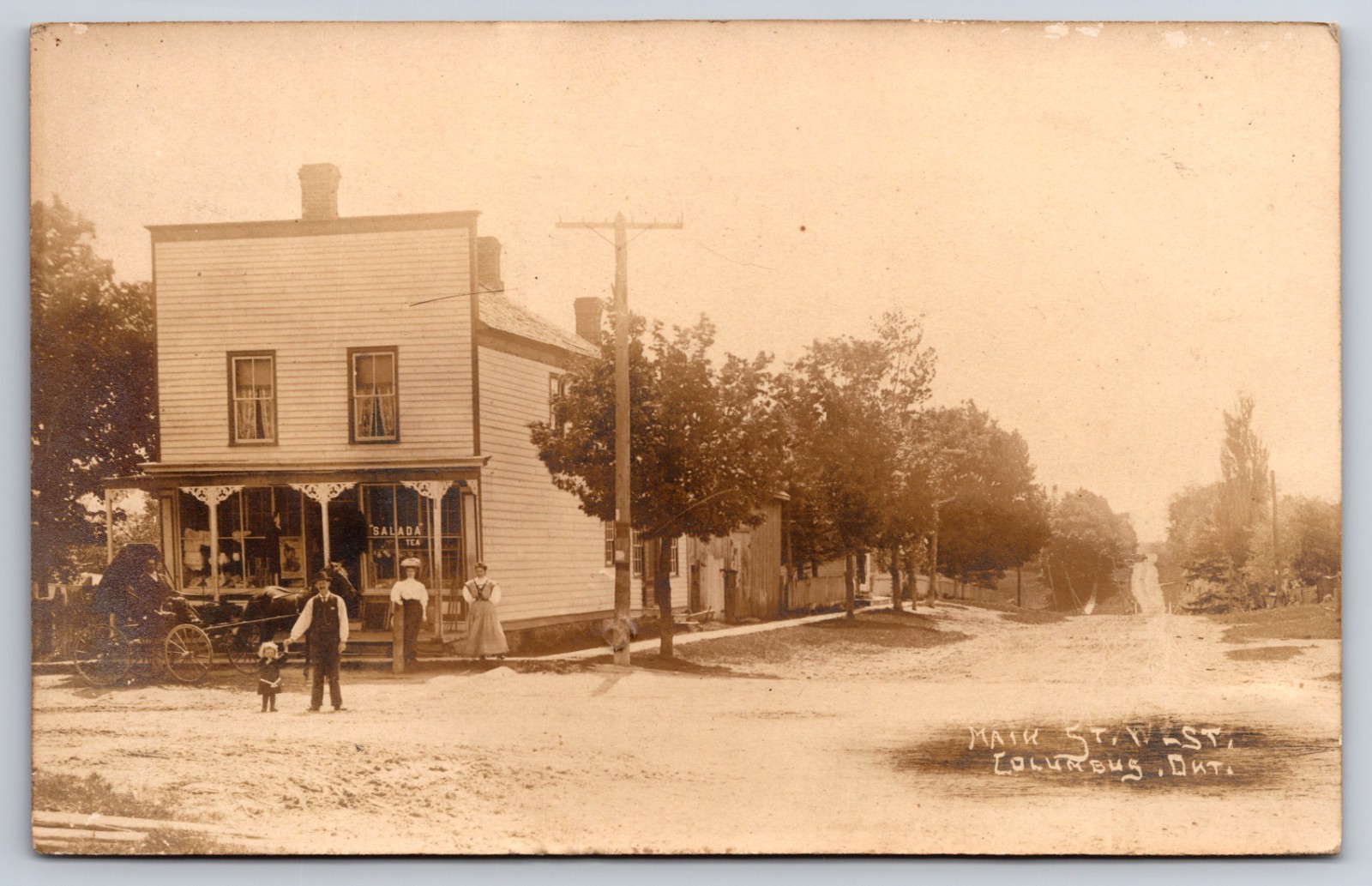
Culumbs Ontario Canada Street View 1910 Real Photo Postcard

Columbus, Ontario, historically a small hamlet within Whitby Township (now part of the Town of Whitby), emerged in the 19th century as a modest rural community. As depicted in this early 20th-century street view, its character was defined by residential dwellings, unpaved roads, and a strong connection to agricultural life. The presence of utility poles suggests the gradual introduction of modern infrastructure, marking a period of incremental development in this quiet corner of Ontario.
These types of small Canadian communities served as vital local hubs, supporting surrounding farms and providing essential services. The scene reflects a period before extensive suburbanization, showcasing a landscape where wooden fences and mature trees lined thoroughfares, and daily life revolved around pedestrian movement and local interactions. It captures a moment in time when technology, like telephone lines, was beginning to connect previously isolated settlements, altering the fabric of rural existence.
These types of small Canadian communities served as vital local hubs, supporting surrounding farms and providing essential services. The scene reflects a period before extensive suburbanization, showcasing a landscape where wooden fences and mature trees lined thoroughfares, and daily life revolved around pedestrian movement and local interactions. It captures a moment in time when technology, like telephone lines, was beginning to connect previously isolated settlements, altering the fabric of rural existence.