Golden British Columbia Early Street View 1912 Real Photo Postcard
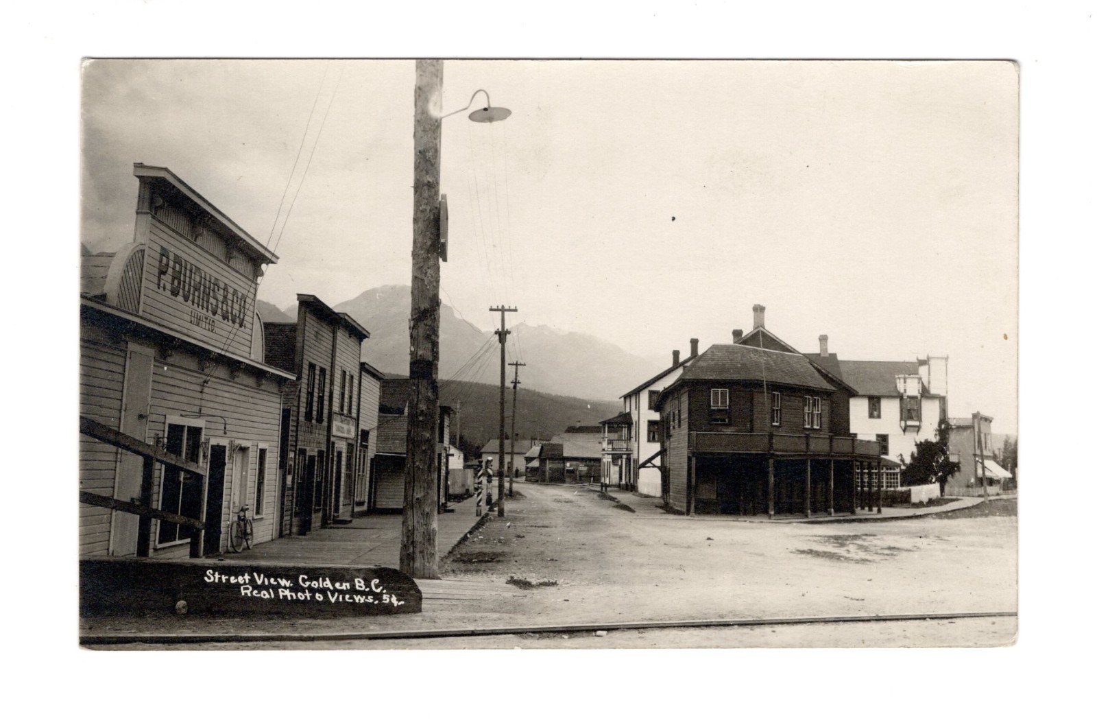
Golden, British Columbia, developed rapidly in the late 19th century following the arrival of the Canadian Pacific Railway (CPR) in 1884. Named by British railway workers, the town was strategically positioned in the Rocky Mountain Trench at the confluence of the Kicking Horse and Columbia Rivers, establishing it as a vital transportation and resource hub. Its early economy centered primarily on logging, sawmilling, and providing services to the railway, as well as serving as a gateway for mountaineering and tourism into the vast Canadian Rockies.
This street scene likely dates from the early 20th century, indicative of Golden's growth as a frontier community. The visible presence of businesses like P. Burns & Co. Limited, a significant Western Canadian meat processing and retail enterprise of the era, highlights the town's commercial importance in supplying local residents and the transient population associated with the railway and resource industries. The characteristic wooden architecture, dirt roads, and nascent utility poles reflect the infrastructure common in burgeoning Canadian towns of this period.
This street scene likely dates from the early 20th century, indicative of Golden's growth as a frontier community. The visible presence of businesses like P. Burns & Co. Limited, a significant Western Canadian meat processing and retail enterprise of the era, highlights the town's commercial importance in supplying local residents and the transient population associated with the railway and resource industries. The characteristic wooden architecture, dirt roads, and nascent utility poles reflect the infrastructure common in burgeoning Canadian towns of this period.