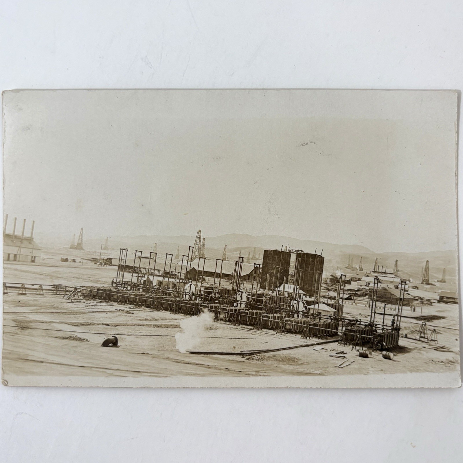
Taft California Birdseye View Oil Boomtown Early Town Panorama Real Photo Postcard

Taft, California, depicted in this early "birdseye view," originated as a significant oil boom town in the early 20th century, located within the vast Midway-Sunset Oil Field. The landscape is characterized by a sprawling collection of modest buildings, many appearing temporary, alongside numerous operational oil derricks that dominate the distant horizon and signify the town's singular economic purpose. Tents in the foreground further suggest a rapid influx of residents and a burgeoning, somewhat unsettled community.
The town, initially called Moron, was officially renamed Taft in 1910 following a visit by President William Howard Taft. Its rapid growth was directly tied to the enormous petroleum reserves discovered in Kern County, transforming the arid region into a hub of oil extraction. This image captures Taft during a crucial period of its development, illustrating the immediate impact of the California oil rush on the state's geography and economy, as communities quickly sprang up to support the burgeoning industry.
The town, initially called Moron, was officially renamed Taft in 1910 following a visit by President William Howard Taft. Its rapid growth was directly tied to the enormous petroleum reserves discovered in Kern County, transforming the arid region into a hub of oil extraction. This image captures Taft during a crucial period of its development, illustrating the immediate impact of the California oil rush on the state's geography and economy, as communities quickly sprang up to support the burgeoning industry.